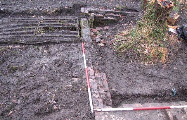
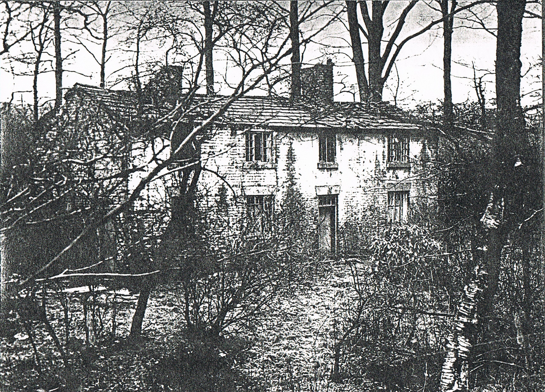
MAS have published a report on their investigation of the Lever Crypt in Alkrington Woods
The Lever Crypt in Alkrington Woods
MAS have published a report on their investigation of the Lever Crypt in Alkrington Woods
The Lever Crypt in Alkrington Woods


A new research paper from Cliff Ivers suggest a reason why so many Middletonians died in 1623. His research is based on the parish records and wills of some of the people associated with golden cluster buildings, the Boar’s head, the old school and the parish church. Not for the faint hearted..

Our society has recently become an affiliate member of VAG . Hopefully MAS members will use the group to help study and survey the fantastic vernacular buildings we have in Middleton. VAG hold a number of conferences each year that MAS members will be able to attend. Also they publish regular journals and have online data bases of items such as tree-ring surveys. If you are interested in getting involved in surveying Middleton buildings, please drop me an email….. cliffivers@gmail.com

David Morris and Geoff Wellens have discovered the extent of Middleton Park, the estate of the Barton/Assheton Lords of Middleton.
http://artsandcraftschurch.org/boundary-of-middleton-hall-park-discovered/

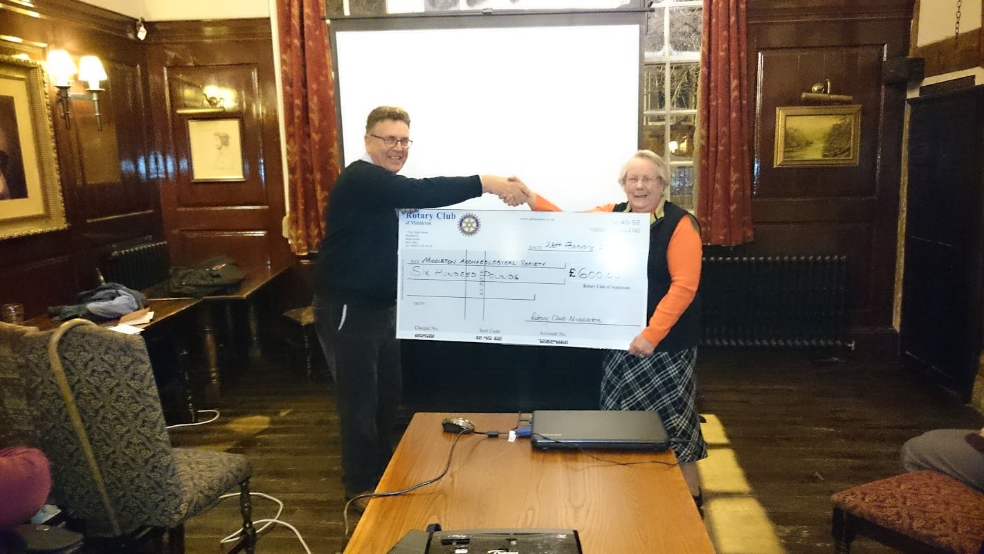
Cliff Ivers receives the cheque from Audrey Riches
We have been successful in our grant application to the Rotary Club of Middleton. They have awarded us £600. This money will go towards our costs of running the St. Leonard’s Church House – The Grapes Inn excavation in August and September 2015. Cliff was on hand to receive the cheque from Rotary Club member Audrey Riches.
We have a very busy year planned in 2015 culminating in a four week excavation of the Church House cellar next to St Leonard’s. We hope to have an open day on the last Sunday to coincide with Middletons heritage weekend.
We start work in March attempting to date the stone foundations found next to Tonge Hall. Also we plan to fully excavate the foundations of the Millers Cottage next to Hopwood Corn Mill.
Please drop me an email if you wish to book a place.
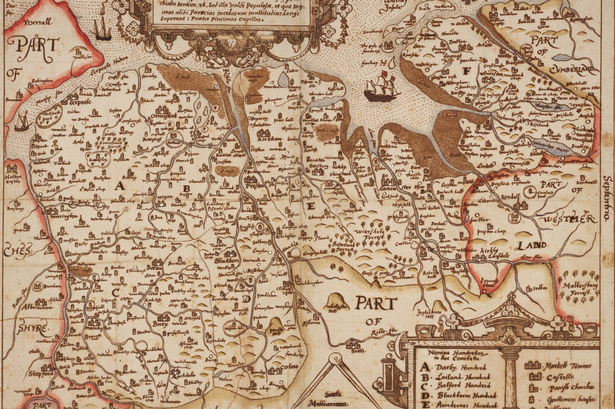
A unique 17th century map of Lancashire found at John Rylands Library has been placed on display for the first time in 400 years.
The unique 17th century map found at the John Rylands Library
The Elizabethan hand-drawn document, which shows towns and villages including Diddsbury (Didsbury), Garton (Gorton), and Stopford (Stockport) – provides a fascinating glimpse into centuries past.
The map was created by cartographer Herald William Smith and has lain virtually untouched in the Manchester library’s collection for nearly 40 years.
The spidery script – which could almost be taken from JRR Tolkein’s Lord of the Rings – shows that present day districts were known by different handles during the time of William Shakespeare.
The map, which shows the Rivers Tame and Irk in striking detail, includes districts such as Straingwaish (Strangeways), Wordsall (Ordsall), Edgcroft (Agecroft). and Prestroich (Prestwich).
It is thought the map was made between 1602 and 1604 – long before Manchester became a thriving industrial powerhouse.
The document was bequeathed to the Manchester University-run library by Leonard Penna, a collector from Cornwall.

Our October clean up of the old mill has been reported in both the Middleton Guardian and Rochdale Online


 MAS has hit the headlines again, only nationally this time. Our recruitment poster and Autumn programme was seen on the BBC News at Six on Friday 3rd October at the tail end of a story on the By-election next week.

