During the Roman occupation of Great Britain (43-410 AD) the Roman Fort at Castlefield, Manchester became a central hub in the road network that supported the military occupation of the North West.
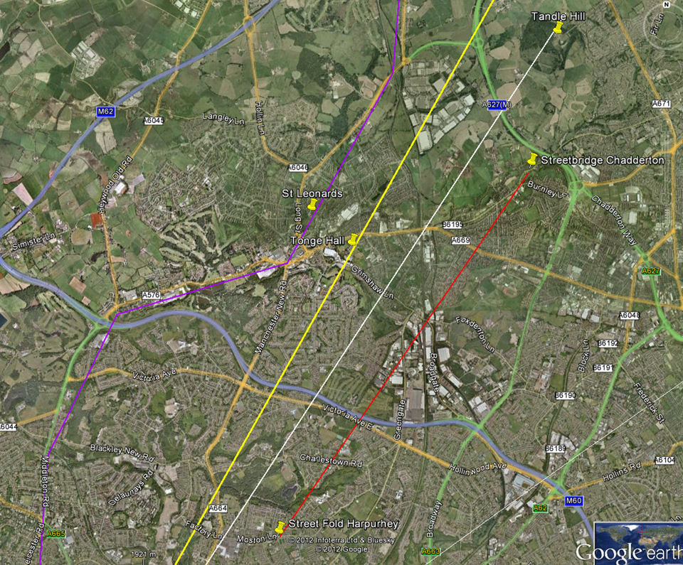
It is assumed (Fig 1.) that a Roman road travelled from Manchester to the fort at Ilkey, Yorkshire; a direct alignment drawn between these two locations would pass just west of Middleton town centre and close to Tandle Hill before heading towards Milnrow, Littleborough and Blackstone Edge and across the Pennines.
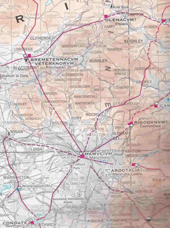
Fig 1.
First references to the road can be found in a legal document of Roger de Middleton in 1240 (Fig 2.). This refers to a ‘great highway’ at Balderstone, Rochdale as a boundary to his land.
In 1781, a Roman historian, the Rev. John Watson, wrote ”From the end of Long Millgate at Manchester this road went through Blackley, near the foot road to Middleton, leaving Alkrington House to the west; crossing over the meadows to Middleton Hall, and over Barrow Fields, as the foot road goes over Hopwood Demense to Trub Smithy(Castleton)…”
The location of Watsons “foot road to Middleton” is unclear. A 1720 (Fig 3.) of the coach route from Manchester to Leeds shows a carriageway to pass Cheetham Hill, Heaton Hall, Middleton Centre and Hopwood, probably along the route of the existing Manchester Old Road and Long Street past the Olde Boars Head pub. The existing Manchester New Road was built about 1820 along a more direct route to Middleton.
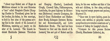
Fig 2.
Another route through Middleton is suggested using old place names with Roman connections, such as Steet Fold, which used to be on Moston Lane Harpurhey, Street Bridge Chadderton and Street Gate in Royton. This alignment would suggest a road closer to Greengate (another possible Roman reference), following the Middleton / Chadderton boundary on Blackley golf course.
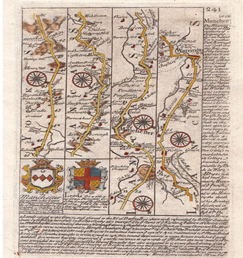
Fig 3.
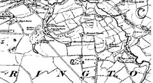
Fig 4.
The 1844 ordinance survey map of Alkrington (Fig. 4) shows an area known as Mount Pleasant – a name often associated with Roman Settlement on a hill. Mount Pleasant became known as Alkrington Mount and is probably why Mount Road bears this name.
There have been numerous roman finds in Littleborough and Rochdale including coin hoards which suggest Roman settlement in the area. Middleton only has two reported finds, a Roman Jug excavated in 1897 and a coin (270AD) found near the River Irk in 1987.
The Romans constructed their roads using gravel and stone, most of which was probably reclaimed by subsequent settlers as foundations for buildings. The industrial revolution and growth in population has dramatically changed the landscape of North Manchester making the search for the missing Roman road through Middleton very difficult.
Satellite View of Potential Roman Road Alignments
Purple – 1720 Coaching Route
Yellow – Direct alignment between Manchester and Ilkley
Red – Street Fold Harpurhey to Street Bridge Chadderton
White – Visual alignment between Castlefield and Tandle Hill